Chase/Project Report 5-21 through June 4th, 2000
Tornadoes: 0 (some LP midlevel funnels)
Location: Goodland, KS County Wartning Area
Time: Daily operations of the STEPS project
Alas, research is not like chasing... While remaining anchored to the core of the STEPS program in Goodland, KS. Much of the time I spent on this project was devoted to studying mesoscale boundaries using the mobile mesonet vehicles. The very high resolution data obtained with this experiment will likely give insight to how boundaries evolve and focus developing convection. (Something I'm sure all of us would find useful! --and I'm not kidding, we REALLY need to understand this stuff!)
I also got to spend a great amount of time with wonderfull people from the world of weather. I found this absolutely wonderful, and I can't explain how much this meant to me personally.
Chase Report 5-16,17-00
Tornadoes: 0 (some funnels)
Location: western NE, northeast CO, and northern KS
Time: Tuesday and Wednesday afternoon
Neither day was a bust as far as I'm concerned. The two day chase of a deep low pressure in the western plains produced many great towering clouds and beautiful sunsets. I'll post more on this chase soon, but for now, you can check out a few of the photos!
Chase Report 5-11-00
Tornadoes: 12+
Location: near Waterloo, IA
Time: 7-830 PM
Today's chase goes down as possibly one of my best in all elements of chasing.
The day began in Davenport Iowa at 7am. I drove to meet team member Terry Welsh in Ames, IA at 11am. After arrival and analysis of data/forecast models, I decided that the area near Waterloo, IA would be the best location for the the shear parameters, instability, and ability to break the cap of warm air aloft that inhibited convection all day. The cap weakened over central Iowa through the late afternoon as we followed the triple point just north of highway 30.
As the storm neared northeast Iowa, the cap broke and the convection exploded. We got into position for developing storm 10 miles to our north. While coming around the southwest flank, the storm was warned as severe, for large hail. (we could see the hail shaft clearly and stayed clear of it!!) The only hiccup occurred as we had to follow the updraft through northern Cedar Falls. Extensive tree damage was noted as we passed through the city. The eastern side of the city had major powerline damage as well as several partially destoyed buildings (a nursing home received severe damage from both the tornado and obliterated trees falling on the building).
We then followed the storm east for the next 3 counties. It produced many tornadoesas it went through several cyclic processes. (unfortunately these links are often down :( ) While following a large double tornado familyfrom one meso, a second wall cloud developed rapidly behind our vehicle. This produced a weak F0 F1 that got within a 1/4 mile of us! (yep, we got that on video!) Rainwrapped to backlit in the clear, and needle to wedge, the tornadoes continued to drop. INCREDIBLE!
I will definetly post pictures right here...as soon as we stop and develop film and capture stills from video.
This was the best tornadic storm in Iowa in my memory; and I've been here my whole life.
Andy Ervin
Chase report for July 22-23, 1999:
Thunderstorms unleashed all the rage on Minnesota last night! Oh of course, my chase team and I were there to see it all. A viscious bow echo gathered strength near eastern South Dakota by 10 pm July 22. In three hours, this storm moved across the enter state of Minnesota. Wind damage followed. Our crew set up shop over western Carver county Minnesota then changed position to just east of Mystic Lake Casino just to the south. We watched the **very** impressive gust front cruise by with 40-50 mph winds in our face. However there was little impressive lightning to be seen. With the cell moving east/northeast and good road system, we tracked it all the way into Washington county to the east. After 20 minutes of beautiful video we ventured west to Eagan, Minnesota. KA-BLAMMM!!! Outflow induced storms fired in the vicinity and we got bombed by amazing and hair raising (quite literally) cloud to ground lightning. We took a stike about 100 feet off the car at one point. This acivity raged till dawn and many roles of film documented it
Chase report for June 10th, 1999:
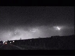
After a breif stint to Northwest IL, I am now back up north. On June 10th, I was at ground zero for a strong wet microburst, near Andelusia, IL. This cell, produced hail, blinding rain, 55mph wind, and extremely frequent cloud to ground lightning. (unfortunately this storm claimed two lives from a lightning strike) I did get much of the storm on video and here are the stills of one of the most memorable bolts!!
Chase report for June 8th, 1999:
Wow, this week has been busy!! No significant tornadoes to my credit, but Man, I've seen some good storms! Today, I ventured south to the MN/IA border in hopes to catch a severe cell on the outflow boundary / warm front in the area. Well, success!, a slow east moving severe cell was caught at 3:15pm in southern Faribault county in south central MN. As I got to the storm, it was presenting a fierce looking shelf cloud. Behind that, the sky was pure green! DON'T GO THERE!!! To my east, another cell developed repidly on the outflow of my first storm, this cell quicky produced a nice white hail shaft viewed from the west. Without a quick road in any favorable direction, I decided to take as much video of the outflow as possible. THIS PAYED OFF!! Underneath the shelf cloud, several strong gustnadoes formed with dust and small debris drawn up and estimated 500 feet into the air. Winds gusted to 60mph as I attempted to keep control of my car on the gravel roads. By the time I "escaped" the situation, my blue car was a ugly mix of yellow and brown from the thick dust.
Tonight looks like a good overnight lightning photo op in central MN. I'll be awake another night for this one. Tomorrow, Wednesday, looks potentially severe in MN, if the dynamics come together during the peak heating. I expect the best activity to wait untill evening. Ahh yeah; "I ain't got TIME to SLEEP!!!"
Chase report for June 6th, 1999:
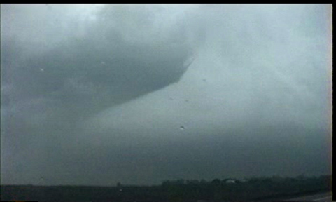
OOhhh; ya gotta like a 120kt jet cutting north with a negatively tilted 500mb short wave in early summer. Jargon asside, this means high amounts of energy released by a very strong system. Today was a very local chase, I only went out about 15 miles west. Since storm cells were moving north at 50-60mph, we let cells come to us. Our position was located near the south end of Flying Cloud Airport in eastern MN. We winessed the passing of a supercell, to our west that produced baseball hail!! At about 5:30pm, a second line of cells moving slightly right of north, came toward our position. The westernmost cell, breifly produced a very small funnel, which did not touch down. Pictures of the funnel can be found below. This cell, later produced 3/4 hail and damaging wind gusts over the eastern Twin Cities.
The night concluded with a final storm over Dakota county MN. A small wall cloud, damaging micro bursts, and a well organized (from a visual perspective) hail shaft were seen by the crew just before dark.
Chase report for May 22th, 1999:
Mmmm... Multicell severe storms. After dark... I think not. I will stay in IA today and wait for some lightning photography later tonight. Due to the ignition of cells in the plains already this morning I do not doubt the formation of storms today. However, I believe there will be extensive areal coverage and lots of heavy rain associated with them. ---not to mention hail...(welcome to my world, Project Vortex 99!!)---> can't wait to see the video from the hail near Pampa, TX. The system shifts east quickly so I am not sure chasing will be feasible on Sunday either, but if it is poss, my current position in eastern IA looks like a good starting point.
Chase report for May 21th, 1999:
Another day of rest??! Extensive showers and t-storms overnight has overwhelmingly ,($50 word!), put a lid on any severe wx for today over the northern plains. Today will be just a regular drive day as I visit some folks worth seeing. Tomorrow looks interesting, but the ETA backed off a outbreak across western IA this run, so we'll just wait and see if tomorrow will be a go day, later today when the new models come in. andyout.
Chase report for May 20th, 1999:
Yesterday was quite the lame chase. for the first time in a long time (well overdue), I busted. Straight up and no contest. I may would been able to stay until sunset and seen a weakening bow echo where I was, but this isn't my idea of a good time. We did locate outrselves on the dewpoint gradient in extreme southwest IA (Fremont and Montgomery counties.) Here, temps and dewpts both jumped 10 deg. This did serve as a niceboundary for which the north bookend of the bow echo to ride along, but again, I really wasn't that excited about seeing that kind of show; especially when Star Wars is playing. On the way back to Ames, IA, we were blessed with an amazing high based lightning display. Oh well, lightning won't be enough to put this one out of the "Bust Bin". andyout
Chase report for May 16th, 1999:
May 16th. Well, today gave us everything except the touchdown. We began the day in Hastings, NE. After waiting till the new model run came in, we headed east into southeast NE. By 2pm, tornado warnings began to spin off the AM dial like crazy...it was painfully obvious that we were too far west. Not to worry, we did have several very aggressive towers forming in our vicinity. Though photogenic, they proved too slow for my patience. We headed east into southwest IA. In IA, we quickly moved into a good visual position for the updraft of a storm in Fremont county. This storm was slow to move, thus making positioning ourselves rather easy. Within 30 min, a well defined meso had developed with this cell. For the next 30 min, we witnessed many funnels form as it moved toward Red Oak, IA. Lisa kept a good eye to the rear window during every position change so with confidence I can say that no tornado touched down with this storm before sunset. As is common place in high CAPE events, cells merged and became outflow dominant by late evening. We left our cell, and moved northward toward Atlantic, IA, being careful as to not core-punch any strong cell. The chase concluded with a breif microbust in Atlantic while eating a burger at Mc Donalds. We estimated wind gusts on the order of 50-65 miles/hour with this free car wash. Over all, it was quite an exciting chase day for us where we really didn't miss seeing the tornadoes further north that much. A side note, I sincerely wish the best for the victims of today's storms. No one ever wants to see injury and death with weather, and I'm not any different. Take care and God bless.
Chase report for May 15th, 1999:
Well today was not a total bust. We witnessed 3 funnels but no tornado. Howie Bluestein got a stovepipe just 3-5 miles west of us in Stockton, KS. Tomorrow we will head to northern KS again and join up with the dry line. Let's hope the CAPE gets a little more closer to the predicted ETA model. If so, the dry line will be very active once again. Wish us luck(Lisa, Andy, and Terry)!!!! By the way, NSSL's Project vortex was on the same storms today as us...very cool...since they never come up to see us Minnesota folk up in my neck of the woods.
Chase report for May 10th, 1999.
The day began with a sunny start in Ames, IA. All of IA was within a strong southeast flow at the surface with moderate southwesterly flow aloft. The initial chase zone targeted was northwestern IA, near Souix City, where the best backed surface flow, predicted CAPEs, and proximity to the cold front would be maximized. Well, as Murphy's Law would predict (Jim Murphy?), midlevel cloudiness from morning convection over central NE ruined the CAPE in western IA and eastern NE. After a breif jog over the border into NE, I decided that the CAPE situation was without remedy and headed back to central IA, where temps had reached into the low 80s in DSM.
Enroute to central IA, we encountered several bands of high based convection. Each cell seemed stronger than the previous as we drove east. By the time we reached Ogden, IA, timing placed us at the front of the storm. An aggressive shelf/roll cloud had formed on the cell. We watched this for a short time, before it overtook our position. Well, who says high based IA storms can't kick a little Butt!! We held tight as 40-50 KT winds blew dust and then blinding rain at us. We quickly headed east to watch the storm roll on by.
So the question for today would be: Do you think today was a bust? All this driving for a nearly severe storm only 20 miles from where we started from. Who knows?
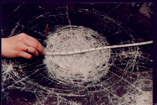
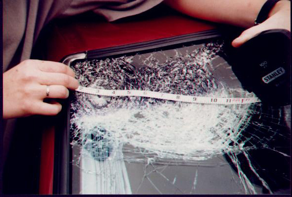
The famous hailstorm's rath. May 1998; Terry Welsh and Andy Ervin venture to southcentral NE in search a *big* supercell. Years of forecast experience allowed the team to efficently find and persue the supercell. Alas, this experience didn't include good knowledge of what a weak echo region looked like out in the western plains. A quick learning tool was given to the team as their vehicle was beaten to a moonscape by 3-5" hail. Shown below is the famous 10 inch depression in our front windshield. Don't believe me...check the measuring tape!!!
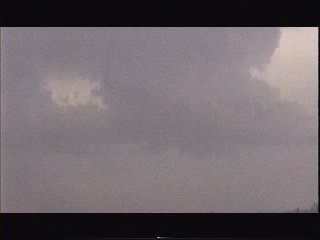
June 6th, 1999. Looking south from Flying Cloud Airport. A small funnel can be seen developing a the base of a strong updraft as the storm moves north at 50mph!!
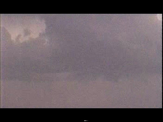
Minutes late, without a touchdown, the funnel begins to pull back into the storm.
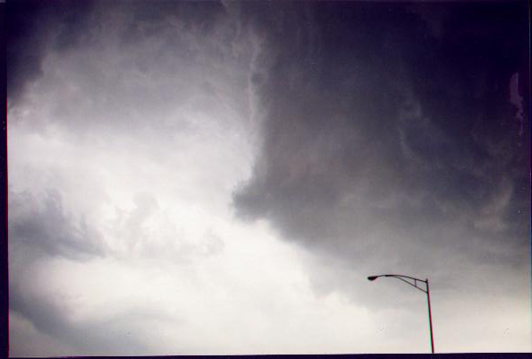
May 16th, 1999. Looking east at the conclusion of a chase over western Iowa as described above.
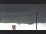
July 10, 1998. Looking south from under a massive shelf cloud in advance of a severe thunderstorm over extreme western MN. A gustnado can clearly be seen just to the right of the road sign! (a bigger photo will be linked soon!)
May 30th, 1998. Looking northeast near St. Cloud, MN. A strong updraft of a severe storm pulls in moist air into its updraft. Moments later as darkeness limited camera use, a very large inflow cloud, or beaver's tail was seen.
 While following a large double tornado familyfrom one meso, a second wall cloud developed rapidly behind our vehicle. This produced a weak F0 F1 that got within a 1/4 mile of us! (yep, we got that on video!) Rainwrapped to backlit in the clear, and needle to wedge, the tornadoes continued to drop. INCREDIBLE!